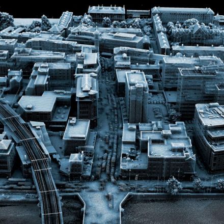
Satellite images let us see Earth from above. But a technology closer to Earth can give us a much more detailed look. Aerial “light detection and ranging,” also known as lidar (rhymes with eye-dar), works by sending laser pulses from a plane, helicopter, or drone. The device then receives information back about the surfaces below.
Read more:
https://www.nationalgeographic.com/magazine/2018/02/explore-lidar-imaging-technology-dublin/?source=Snapzu
No comments:
Post a Comment